ENG
Satellite Compass CS-50
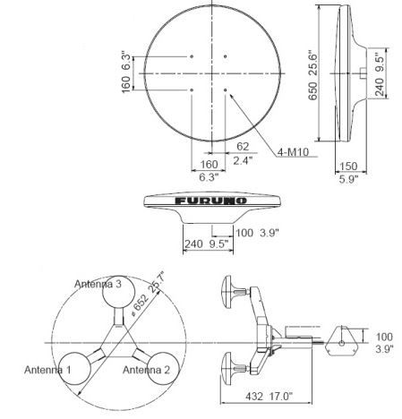
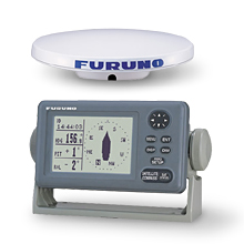
The Furuno SC-50 satellite compass uses advanced GPS technology to accurately determine direction, making it an ideal choice for integration with AIS, ECDIS, ARPA radars and other navigation systems. This compass is adapted to a variety of ship types and provides high flexibility by customizing the output data and transmission speed in each port. The SC-50 provides accurate determination of the vessel's position by transmitting information to radar, plotters, AIS and echo sounders, and a system of three antennas reduces the impact of keel and side pitching.
The Furuno SC-50 compass is equipped with four display modes: compass, ship control, navigation data and ship's course. Due to the absence of mechanical components such as the gimbal, the need for maintenance is minimized.
Technical specifications:
- Error in determining the course: 0.5
- Resolution: 0.1
- Initialization time: 3 minutes
- Location accuracy: 10m (standard), 5m (with DGPS), 3m (with WAAS)
- I/O ports: 10 ports (IEC61162-1/-2) or 5 AD-10 ports, 1 AD-10 port
- Output data: HDT, HDM (heading), ROT (turning speed), ATT (keel and side pitching), HDG
- Input data: DGPS, HDT, HDG, HDM, VBW, VHW, VLW
- The temperature range of the antenna unit/sensor: from -25 to +70 C
- Moisture protection of the antenna unit/sensor: IPX6
- Moisture protection of the interface unit: IPX0
- Power supply: 12-24 V DC
- Current consumption: from 1.2 to 0.5 A
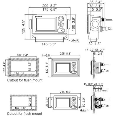
- Display: 4.5-inch monochrome LCD
- Effective screen area: 95x60 mm
- Display resolution: 120x64 pixels
- Display contrast: 64 levels
- Display operating temperature range: -15 to +55C
- Display moisture protection: IPX5


Available for order
Documentation:
 +7 (812) 4-673-673
