 +7 (812) 4-673-673
The Navigator ' s choices can affect the picture
The idea behind a navigation system is to provide the Navigator with easy access to the information that is necessary to arrive at a decision. The Navigator has to choose what information he need to see on the screen in order to keep situational awareness.
There are four basic navigational situations in which the screen appearance and informational needs are different:
- Ocean navigation
- Coastal navigation
- Archipelago navigation/restricted waters
- Harbour manoeuvres
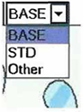
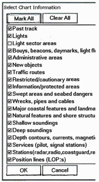
ECDIS has three standard set-ups for informational content: Basic, Standard and All. One cannot remove any information from Basic (which is not actually intended for navigational use) but the others can be modified by the Navigator. In an ECDIS the Standard setup shall be accessible with a one-button command.
Base Display shall always be displayed on the screen and comprises:
- Coastline (high water)
- The Safety contour for one's own vessel
- Marks of individual submerged navigational dangers having a shallower depth than the Safety contour
- other specific navigational dangers within the safe Area, such as power lines, bridges, buoys and buildings such as lights.
- Traffic Separation Systems, Archipelagic Sea Lanes
- Scale (range), orientation and display mode
- The units for depth and height
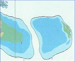
 Base display
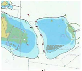
- Everything in Display Base
- Low water mark (drying line)
- Fixed and floating navigational aids
- Boundaries of navigable channels, canals, etc.
- Landmarks, radar targets and conspicous objects
- Forbidden areas and restricted areas
- The boundaries of electronic charts with differing scales
- Markings for warning and safety information
 Symbol that shows information has been suppressed from the Standard Display mode
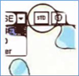
Standard display The icon for Standard Display on the ribbon
All display
- Depth values
- Underwater cables
- Ferry routes
- Details regarding free-standing dangers
- Information regarding aids to navigation
- The contents of warning messages
- ENC dates of publication
- Geodetic datum
- Variation
- Lines of latitude and longitude
- Name
 All display
A smaller screen will require the Navigator to choose what information to display, as a smaller screen quickly becomes cluttered so that some information may end up hidden.
Экран настроек
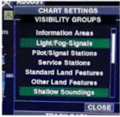 Different menus for settings
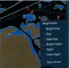
Different appearances of menus to improve the visibility of the screen under different lighting conditions. ECDIS must have at least three preset colour-coded displays, but more options may be provided.
- Day (white background)
- Dawn/Dusk (dark background)
- Night (dark background)
Supplementary information
Information that is not directly associated with the electronic chart can be appended to the screen as an "Overlay". This could be Radar, AIS, tidal information or weather information.
A radar display overlaid on the electronic chart gives the Navigator the possibility to quickly check the accuracy of the GNSS position, summarise the situation with regard to the surrounding waters and to any TSS that may be present. This helps to anticipate the future movements of other vessels. The combination of radar/electronic chart can show if there is a difference between the geodetic datum of the GNSS position and that of the electronic chart, as well as any compass error that may be present.
In addition to the electronic chart, the data base can store supplementary information, supplied by the publisher or entered by the Navigator. Manufacturers have different solutions for presenting information and for linking it to the electronic charts.
Moving the cursor marker over a symbol will often cause extra information to pop up in a separate window
Protection of ENC contents
The standard S-63 defines the data protection scheme for ENCs and adds a digital signature so that the user can verify the electronic chart. In order to view and use ENCs that are protected according to S-63 a user will need access to an encryption key. ENCs are protected by individual encryption keys that are adapted to one special system and they therefore cannot be shared by other systems. Encryption keys are distributed to the end-user by sales outlets as "Cell Permits". Encryptation does not add any additional functions. Everything connected to encryption is automatically carried out by the system. The user will receive a new Cell Permit when the subscription is renewed or the electronic chart library is altered. The new Cell Permit must be imported into the system before new ENCs and correct ons will work.
Unofficial vector charts
In addition to official ENCs, a number of vectorised electronic charts are available from various publishers. These publishers use facts that are available on the open market, that is to say, paper charts and other maps, as well as nautical survey data bought from official sources.
Vectorisation requires that a publisher has rearranged the original data and chosen a certain way to present it. The basis for this choice is not necessarily obvious. One goal may be to reduce the amount of data, while another significant factor could be to decrease the labour involved and thus the costs. Many unofficial electronic charts contain additional information about harbours, etc.
As the content is not regulated by either S-57 or S-52, the cartographic presentation may be different from ENC and vary from publisher to publisher. The prudent navigator will familiarise himself in advance with this type of electronic chart, check what is shown at different scales, test various settings, and so forth. Some of these electronic charts have to be displayed on a specific brand of plotter (see p. 81-82 regarding surprises connected with privately-published electronic charts).
A number of unofficial publishers have bought S-57 data and produced their charts from this. But the charts are still unofficial, ENCs, and they will use to some extent different symbols from S-52.
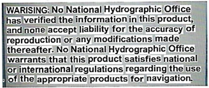
Chart plotters using unofficial vector charts will display this warning on booting
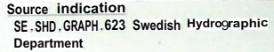
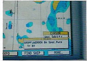
Information about the source used for a vectorised electronic chart in a chart plotter (Swedish chart 623)
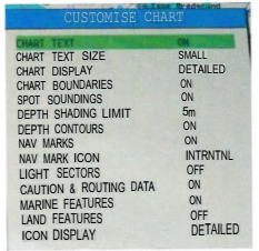
A settings menu for an electronic chart Privately-published charts have many of the functions found on ENCs
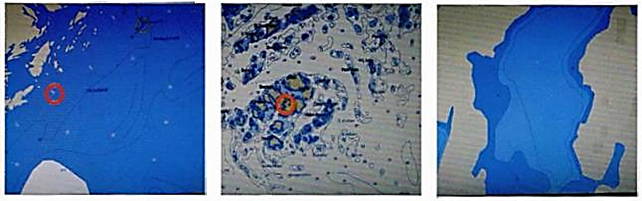
The informational content of a vector chart varies when displayed at different scales. This is determined by:
- the publisher's standard (appearance of symbols and rules governing their display at different scales).
- choices made by the Navigator.
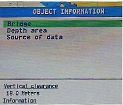
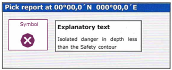
By positioning the cursor on an object Information and pressing ENTER, more information will be displayed. When the cursor is positioned over a navigational mark, more information will appear in a new window ("popup" window, info box; pick report) on pressing ENTER
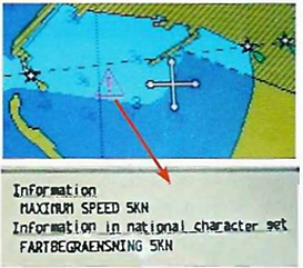
A triangle containing an exclamation mark indicates that further information can be brought up with the cursor, in this case a speed limit
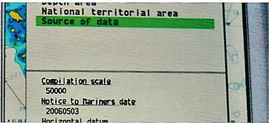
This shows that the original source was a chart at scale 1:50 000 and it was corrected to 20060503