 +7 (812) 4-673-673
World-wide Navigational Warning System
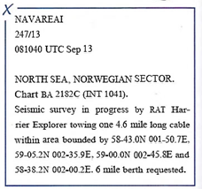
The International Hydrographic Organisation (IHO) and International Maritime Organisation (IMO) have created a common system for navigational warnings. Warnings are published in NtM, are broadcast in English on NAVTEX and on VHF.
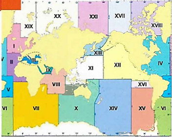
Navarea warnings cover the whole world. For this purpose the world has been divided into 21 geographical regions, with one responsible authority for each area.
Local warnings may be broadcast in the local language and/ or English. Many warnings are temporary, others may have a longer applicability and then be replaced by an NtM notice.
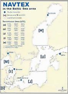
1. NAVTEX
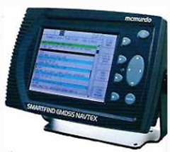
NAVTEX is a coastal system for the automatic transmission of nautical safety information (MSI traffic, Maritime Safety Information). Specific coastal radio stations transmit on the 518 kHz frequency at set times. All communications are broadcast in English. The Navtex receiver shall be installed on the bridge and monitored at set times. Information can be shown on a screen or printed out on paper. In order to receive the latest information when in port - switch the NAVTEX on at least 4 hours before departure.
2. Vessel Traffic Service

Vessel Traffic Service (VTS) centres are administered by the Maritime Administration in respective country, in order to increase maritime safety and the environment. Their activity is regulated by SOLAS chapter V rule 12. VTS centres collect information by radar, AIS, VHF, etc. and provide information on meeting traffic and other items of interest, and also receive information from departing and arriving vessels.