 +7 (812) 4-673-673
Navigation by systems
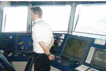
"Navigational systems" is a multi-facetted concept and may embrace rather different arrangements. It has been in use since the 1950s for several systems of land-based transmitters and on-board receivers such as Loran, Decca, etc., and more recently for satellite navigation systems (GNSS) involving satellites, terrestrial monitoring stations and on-board receivers. A wide variety of ship-borne navigational systems are available these days, ranging from certified Electronic Chart Display and Information System (ECDIS) installations to navigational systems for leisure yachts, with radar, echo-sounder, compass, wind instruments, all connected to a chart plotter. The intention is to make navigation easier by making functions automatic. This should lead to safer voyages - and more time for keeping a look-out!
Currently about 30 ECDIS systems can be found on the market. Even if they have many common features they also have important differences of detail. The navigational system instruction manual is essential to discover individual system in detail how to use all these functions.
Any navigational system that is not a certified ECDIS unit is in principle an Electronic Chart System (ECS).
An on-board navigational system consist of: • Sensors (GNSS, radar, compass, log, echo-sounder)
- Computers, displays and network
- Navigational programs
- Electronic charts
A lot of systems are put together with components from different manufacturers. All the individual units of an ECDIS system, and the installation itself, shall be certified by the appropriate authority.
Some chart plotter manufacturers make complete systems available but it is possible to incorporate instruments from other manufacturers.
Although navigational systems have many common features they differ in their details. ECDIS must incorporate certain obligatory functions but even these can be implemented in different ways.
|
All parts of an ECDIS system must be quality assured and certified and it must use official, corrected electronic charts and uptodate programs |
Navigational systems consisting of a chart plotter coupled to the radar and other instruments are common on board leisure yachts and small commercial vessels. Marry of their functions are similar to those of more complex systems |
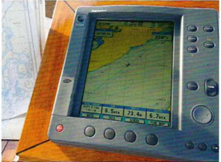
In its simplest configuration ECS may consist of a smartphone, or it may be as complex as an ECDIS system but lacking certification.
Connecting instruments
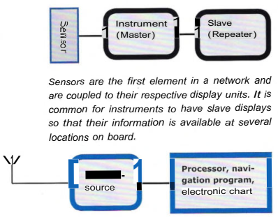
Electronic instruments consist of sensor ' s and display/operator units. In some cases the microprocessor is sited in the instrument (log, echo-sounder) while in others it is usually (but not always) sited in the sensor (GPS, radar).
Some instruments are sold as "black boxes". Several of these may be coupled to a common display unit.
Reasons to connect instruments together are:
- To display their readings at several locations on board
- To collect information about the surroundings and navigational data on a single display
- To enable the system to calculate parameters that the Navigator would otherwise have to calculate manually.
This simple system shows not only the position of the vessel as latitude and longitude but can also display the position by an icon on the electronic chart (see figure 1.1 ). It is also easier to plot routes if the navigation system uses electronic charts. Various alarms and other functions can be accessed if vectorised electronic charts are installed.
 Many systems incorporate a display that can show information from several sensors
Some examples of this type of installation are: a hand-held GPSreceiver with electronic charts, a laptop computer with a GPSpuck with USB interface and a plotter with built-in antenna, GPS and electronic charts.
Navigation without paper charts requires the vessel to be equipped with two fullyindependent, certified ECDIS systems. Even under these conditions "good seamanship" demands that navigation is based on information from several different methods, such as radar, visual observations, dead reckoning and astronomical methods.
|
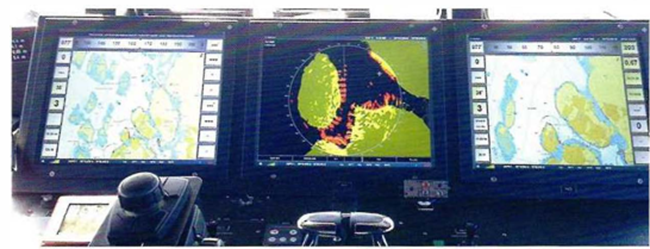
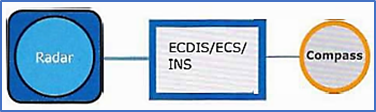
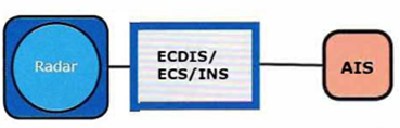
Radar connected to ECDIS/ECS/INS can supply a single, synchronised, overlaid image of radar and electronic chart information |
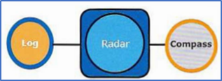
When the radar and electronic chart are supplied with signals from the compass and log, the display can be presented as North up, Course up and True motion |
To enable a radar with ARPA to make a correct estimation of a risk of collision, it must have the Speed Through Water information from the log, not the Speed Over Ground from the satellite system.

|
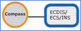
A compass that receives input from a satellite receiver can automatically compensate for variation, using information from the World Magnetic Model (WMM). |
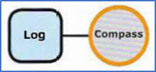
The log and compass supply the necessary information for an automatic calculation of the dead reckoning (DR). From this information the navigation system can display a current vector (the difference between the fix and the DR position). |
A VHF-radio coupled to the navigation system can automatically transmit the position if an emergency alarm has to be transmitted |
.  VHF display with position
|
AIS information can be overlaid on the radar screen or the electronic chart |
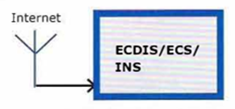
When connected to the Internet, up-to-date navigational information (NtM, VTS) and information |

|
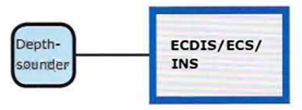
By connecting the echo-sounder to the system, the depth and depth profile can be displayed in a smaller window. Some navigational programs can attach the sounding to a position |
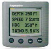
By connecting the log and the relative wind Log instruments and true read it isings for wind direction and force. This information is important during harbour manoeuvres and is displayed at the Conning station |

|
If a NAVTEX receiver is connected with a satellite navigation system it may have the abiiity to automatically select the stations based on the distance to them |
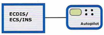
With input from the navigational system the autopilot can steer the vessel along a set route (Trackpilot). |