Course
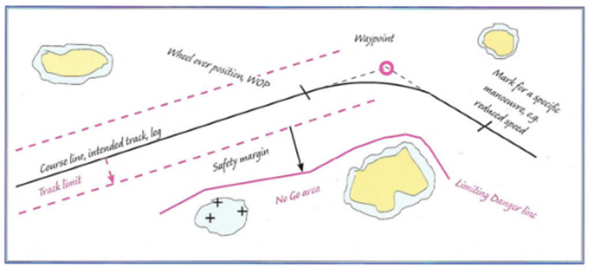
The planned route that is drawn on the chart from a previous position is called the Intended track (in some literature even called Course line). The term "course" is an angle, but the term is used in some other contexts. "Course" may mean an angle, a historical average course, a course read off from the compass or a numerical value by which to steer. In various navigational programs in computers and in books, there are a number of other terms in which "course" is part of.
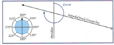
The Course for the Track is described by the angle to the meridian (True North)

In archipelagoes and confined waters, the track may be defined by a line between two identified points.
In this case the track follows the line between two narrow straights
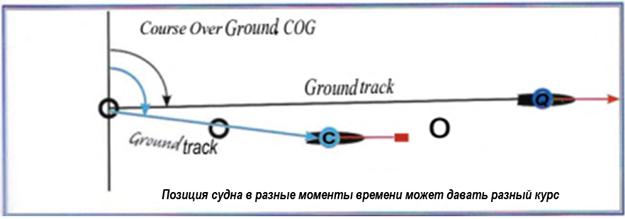
The Ground track is an historic track over a given time interval. Course Over Ground is the angle of the Ground track to the meridian. (Sometimes called Course Made Good)
1. The Loxodrome
A person steering by compass has the impression of sailing "straight and true" but in reality the vessel is following a spiral curve across the face of the earth, the so-called "loxodrome" or rhumb line. This has a constant angle to true north so that all compass courses except 90° and 270° will end up at one or other of the poles..
2. The Great circle
When sailing across oceans the navigator can chose to follow a great circle course. A great circle is a circle on the surface on the earth whose plane pass through the centre of the earth. This is the shortest distance between two points on the surface of a sphere. It passes closer to one of the poles than the corresponding loxodrome, which can result in the voyage entering regions of worse weather. As a compromise one can use a "composite voyage", consisting cf a stage of great circle followed by a stage of loxodrome, then a stage of great circle. A small circle is a circle on the surface of the earth whose plane does not pass through the centre of the earth.
A route consists of a known point of departure, a series of intended course lines with staging points, usually called "way-points" (WPT, WP), and alter course positions that lead to a destination - a point of arrival. During the voyage positions are determined in order to check that the vessel is following the intended track.
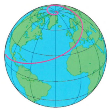
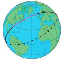 Global chart from mapAbility
 +7 (812) 4-673-673