+7 (812) 4-673-673
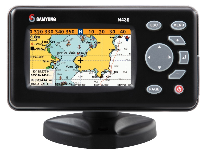
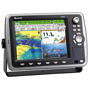
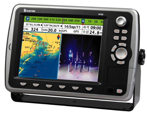
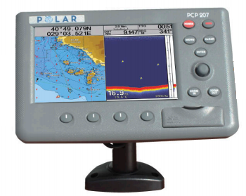
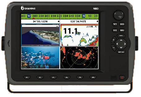
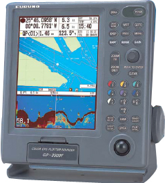
SAMYUNG NAVIS-3800

♦ High speed & safe data process with high speed CPU board
♦ C-MAP NT MAXTM available
♦ User friendly wire/wire-less remote controller & front key panel
♦ Use of duplex frequencies in common offering better
judgement on minute fish group(Option)
|
GPS |
Receive frequency |
L1 1575.42MHz(C/A CODE) |
|
Receivie channel & tracking satellite |
16 channels & 16 satellites |
|
|
Receive type |
Digital 16 channel multi tracking type |
|
|
Receive sensitivity |
-143dBm |
|
|
Accuracy Velocity |
10M 2D RMS(HDOP<2) (SA OFF) / 0.1kt RMS (HDOP<2) (SA OFF) |
|
|
PLOTTER |
Display |
15.1” COLOR VGA TFT LCD |
|
Resolution |
1024X768 PIXELS |
|
|
Projection |
Mercator drawing |
|
|
Effective range |
below 85° of latitude |
|
|
Way point |
20,000 points |
|
|
Effective range |
0.25 mile ~ 5,000 mile(1/2000~1/37,500,000) |
|
|
Tracking memory interval |
1sec~60minute(0.01~9,99NM) set-up |
|
|
Tracking capacity |
20,000 points |
|
|
Mark |
Event mark : 21 kinds / Mark capacity : 10,000 points /capacity for user’s drawing of shoreline : 8,000points 16 land coloring |
|
|
Display mode |
normal, true-motion, course-up, north-up, head-up function |
|
|
Alarm |
1 )arriving alarm 2)off-course alarm 3)anchor alarm 4)boundary alarm |
|
|
Temperature |
Antenna : -40C ~ +50C, Main unit : -10C ~ +50C |
|
|
Interface |
SAMYUNG, NMEA0183, FURUNO(CIF), JRC |
|
|
Power supply |
■ . 50W |
|
|
FISH |
Operating frequency |
50/200KHz 600W(dual) |
|
Display color |
256colors |
|
|
Range of depth |
5~1,500M(depth of water,automatic output power control) |
|
|
Range of bottom |
enlargement of tracing : 10 , 20, 40 , 80M, enlargement of flatterned bottom : 2.5 , 5, 10 , 20, 40 , 80M, partial enlargement : 5, 10, 20, 40, 80M |
|
|
Shift speed |
Stop, low speed, medium speed, fast speed, super fast speed |
|
|
Information |
depth, schools of fish, water temperature |
|
|
Display of function |
Sensitivity, attenuation, transmitting output, time marking, depth, variable scales, color patterns |
Other category products