 +7 (812) 4-673-673
Aids to Navigation
15.12.2021
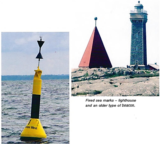
Navigational instruments can be used to perform measurements of objects that are set out on the chart. In addition to using natural objects such as islands, promontories and characteristic hills, humans have aimed to improve maritime safety by setting up sea marks on and and laying out floating sea marks to indicate shallows.
Aids to navigation (AtoN) are:
- lighthouses, especially for navigation at night
- fixed marks and beacons
- floating marks and buoys.
Terrestrial marks
If they are marked on the chart, conspicuous constructions such as churches, masts, chimneys and so forth, can re used for measurements, identifica:on and for visual reference.
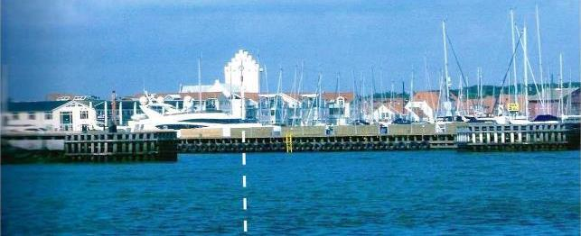
The church, located halfway between the quays, marks the deep canal that leads into the harbor