+7 (812) 4-673-673
Navigational instruments
The compass is used both to steer by and to measure directions (bearings). The magnetic compass is a classic instrument which has been used for many hundreds of years. In spite of the fact there are a number of other modern compass types which are better in a number of ways, the magnetic compass is still essential, even on large vessels. This is because of its robust construction and the fact that it does not require electrical current for its operation. The pelorus is used together with the compass to measure bearings.
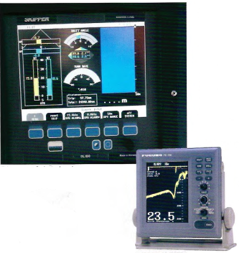
The log measures total or partial distance and/or speed. There are many kinds of log, measuring speed and distance using different electronic methods.
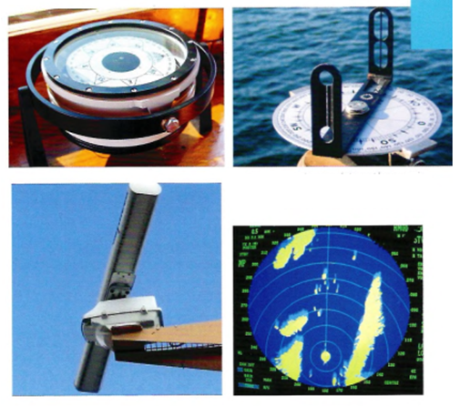
The pelorus is used together with the compass to measure bearings
Radar is the navigator's most versatile navigational aid. It is used for checking the course, fixing position, and to avoid collisions. The rotating antenna transmitts and receives microwaves and the
result is presented on a screen. A radar demands a lot from the navigator in terms of knowledge and experience. It is definitely not an instrument that provides a mass of data at the flip of a switch. The radar screen has to be both adjusted and interpreted!
The echo-sounder measures the depth of water under the vessel by transmitting and receiveing sound pulses.
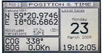
Positions can be obtained from a Satellite receiver (GNSS=Global Navigational Satellite System). Currently those using the Global Positioning System (GPS), set up by the United States, dominate the market.
There is also a positioning system under development which use errestrial signals (eLoran).
Usually the satellite receiver is connected to a computer and a monitor displaying electronic charts and the ships position as a symbol on the electronic chart.
Navigational system can be anything from small hand-held instruments and smart phones to large, integrated systems.
 Display of doppier log
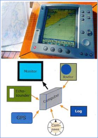 Instruments connected in a network wifi create a navigation system
ECDIS (Electronic Chart Display and Information System) is a certified navigational system that fulfils the requirements of the IMO (International Maritime Organisation). In order to qualify as an ECDIS system all the individual parts of the hard- and software as well as installation must be certified.
Systems that have not been awarded certification are called ECS (Electronic Chart System). & Systems for smaller vessels and leisure yachts have the processor, monitor and electronic charts integrated inside a strong casing. These are called chart plotters.
There are two technically different types of electronic chart, raster and vector charts. They are produced by both governmental and private organisations.
A raster-based electronic chart is in principle just a scanned image of a paper chart. It therefore contains the same information. When the image is zoomed, the details become easier to read but no new information becomes visible.
Vectorised electronic charts have a more variable amount of information, the appearance of which can be changed by the manufacturer and the user.
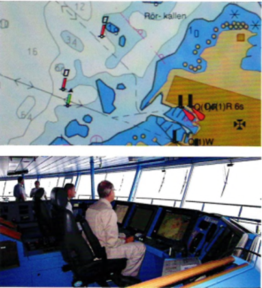
Several electronic navigation instruments that are connected together make an Integrated Navigational System (INS). This displays the results of the different sensors on monitors, together with an electronic chart. The intention is to relieve the navigator of routine work so that more attention can be given to, for example, look-out duties and supervision and to allow greater Situational Awareness.
Integrated Bridge Systems (IBS) are not so clearly defined but may mean the integration of systems for navigation, anticollision, cargo handling, passage planning, engine monitoring, etc.
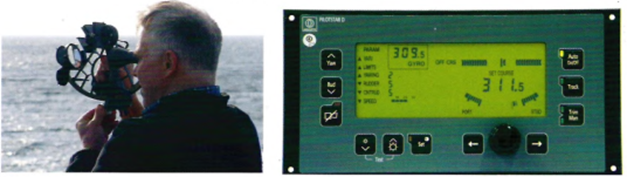
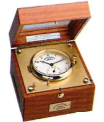
For ocean navigation by astro-observations, an accurate time piece, called a chronometer, is used together with an instrument for measuring angles, called a sextant.
An autopilot maintain the course during most of the voyage. It is not a navigational instrument, rather an aid to keep the correct course.