 +7 (812) 4-673-673
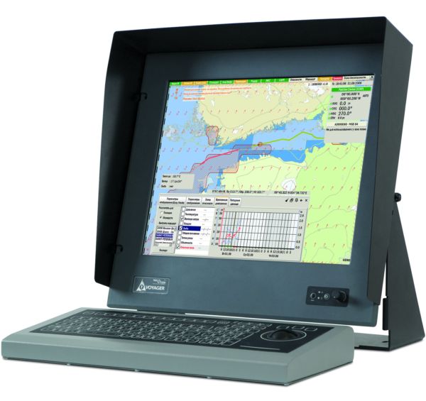
NavCom Voyager
NavCom Voyager
To order
Call our sales manager
Documentation
NavCom Voyager Presentation
NavCom Voyager PC-10/PC-13 Brochure
NavCom Voyager PC-10/PC-13 Brochure


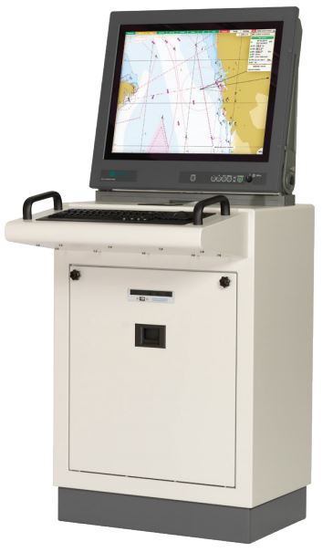
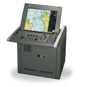
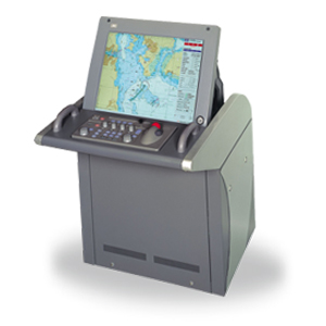
The NavCom Voyager electronic cartographic system (ECS) is designed to ensure navigational safety of navigation and efficient operation of river vessels. EX NavCom Voyager receives, processes and displays information from external electronic navigation systems and devices. The system is designed taking into account modern international studies in the field of ensuring the safety of navigation, including the influence of the human factor.
Main functions:
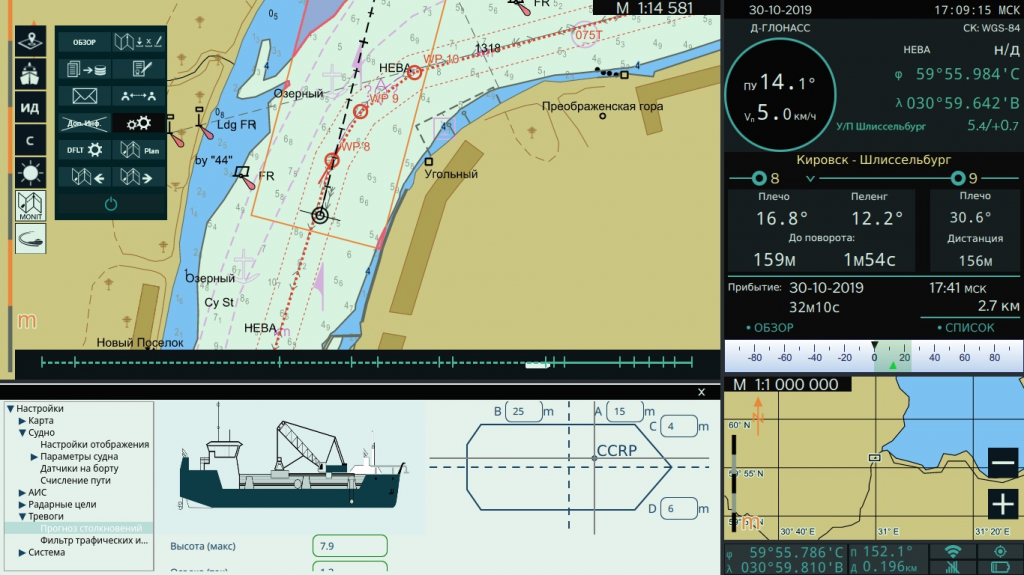
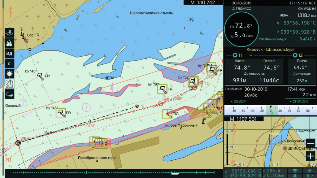
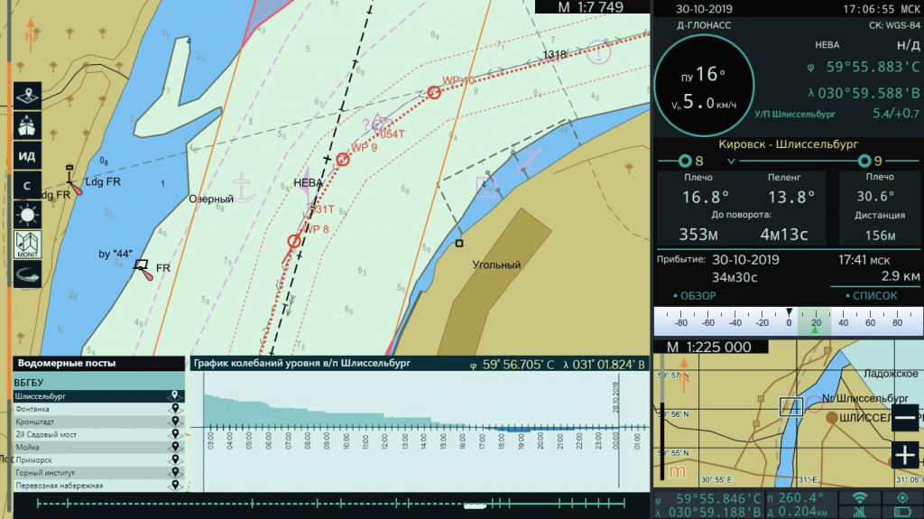
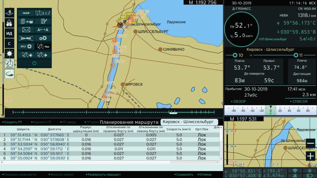
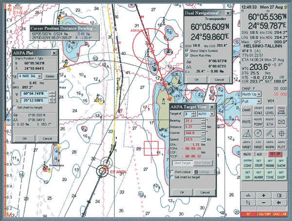
ECS NavCom Voyager allows to carry out automated study of the transition, taking into account the water level according to automatic level posts, building a route and checking it for intersection with mapped hazards, taking into account the dynamic draft of the vessel, creating a time diagram of the flight, taking into account parking and locking time and automatically updating the schedule during flight. Subsequent monitoring of the transition is carried out taking into account the optimal settings for displaying maps for different sailing conditions. The system generates warnings about charted hazards and areas with special navigation conditions ahead of the vessel. Also available to the navigator is a separate overview map or "lens" window, a level chart, bridge profiles, a helmsman's indicator to keep the vessel on a given trajectory, an indicator of the voyage time chart and much more.
Thanks to these advantages, the NavCom Voyager ECS provides a more efficient and visual presentation of navigation information, which reduces the load on the navigators during laying and, due to this, devotes more time to monitoring the environment and developing sound decisions on ship control.
NavCom Voyager PC-10 Package Contents:
Main functions:
- Control over the movement along a given trajectory established during the preliminary laying;
- Signaling when the ship approaches the hazards indicated by the navigator in the areas when the ship approaches the turning point;
- Signaling about violations in the work of ECDIS / ECDIS (use of maps of improper scale, different coordinate systems, failure of navigation sensors and system malfunction);
- Archiving of information about the operation of the main navigation sensors and the surrounding navigation environment with the possibility of subsequent analysis of the movement of own ship and the ships surrounding it;
- Archiving of electronic records of the logbook.
ECS NavCom Voyager allows to carry out automated study of the transition, taking into account the water level according to automatic level posts, building a route and checking it for intersection with mapped hazards, taking into account the dynamic draft of the vessel, creating a time diagram of the flight, taking into account parking and locking time and automatically updating the schedule during flight. Subsequent monitoring of the transition is carried out taking into account the optimal settings for displaying maps for different sailing conditions. The system generates warnings about charted hazards and areas with special navigation conditions ahead of the vessel. Also available to the navigator is a separate overview map or "lens" window, a level chart, bridge profiles, a helmsman's indicator to keep the vessel on a given trajectory, an indicator of the voyage time chart and much more.
Thanks to these advantages, the NavCom Voyager ECS provides a more efficient and visual presentation of navigation information, which reduces the load on the navigators during laying and, due to this, devotes more time to monitoring the environment and developing sound decisions on ship control.
| Specifications |
Voyager PC-10 |
Voyager PC-13 |
Voyager MB-15G |
| Operating system | Linux | ||
| Display diagonal, | 10 | 13 | 15 |
| Screen resolution, inches | 1920 x 1200 | 1920 x 1080 | 1024 х 768 |
| Rated supply voltage (from the docking station), V | 19 (9...36) | 12 | 12 |
| Maximum current consumption (from the docking station), no more than, A |
3,42 (5,55...1,39) |
2,0 | 3,5 |
| Degree of protection of the case (on the front panel) | IP44 | ||
| Operating temperature range, °C | -10...+40 | ||
| Weight with docking station, no more than, kg | 5,0 | 5,5 | |
| Safe distance to the main (traveling) compass, m |
0,4 |
||
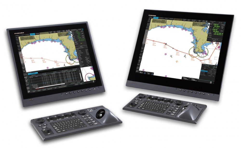
NavCom Voyager PC-10 Package Contents:
- Rugged Tablet PC (10")
- Tablet Dock
- Charger 220V/12V (use only on shore)
- GNSS receiver GLONASS/GPS NavCom Gamma 10
- Mounting kit
- Navigation software
- Software module "GNSS receiver"
- Program module "Compass"
- Software module "AIS" (option)
- Software module "Echo sounder" (option)
- Electronic identification key
- Documentation set
- Rugged Tablet PC (13")
- Tablet Dock
- Charger 220V/12V (use only on shore)
- GNSS receiver GLONASS/GPS NavCom Gamma 10
- Mounting kit
- Navigation software
- Software module "GNSS receiver"
- Program module "Compass"
- Software module "AIS" (option)
- Software module "Echo sounder" (option)
- Electronic identification key
- Documentation set
- Individual PPP certificate (option)
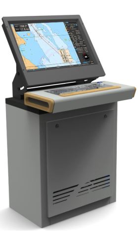
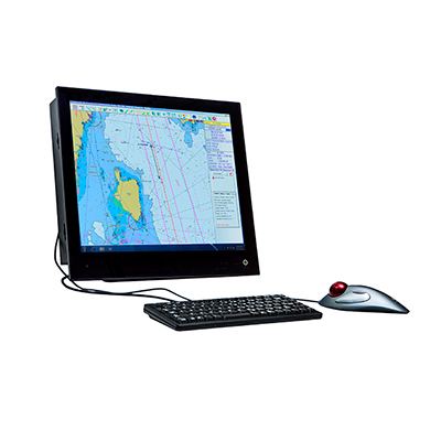
- Monoblock computer (15")
- Flat Mount Bracket
- GNSS receiver GLONASS/GPS NavCom Gamma 10
- Mounting kit
- Navigation software
- Software module "GNSS receiver"
- Program module "Compass"
- Software module "AIS" (option)
- Software module "Echo sounder" (option)
- Electronic identification key
- Documentation set
- Individual PPP certificate (option)
-

Documentation
NavCom Voyager Presentation -
Documentation
NavCom Voyager PC-10/PC-13 Brochure -
Documentation
NavCom Voyager PC-10 Passport -
Documentation
NavCom Voyager PC-10 User guide -
Documentation
NavCom Voyager PC-10 Manual -
Documentation
NavCom Voyager PC-13 Passport -
Documentation
NavCom Voyager PC-13 User guide -
Documentation
NavCom Voyager PC-13 Manual -
Documentation
NavCom Voyager PC-13 Certificate RRR -
Documentation
NavCom Voyager MB-15G Brochure -
Documentation
NavCom Voyager MB-15G Passport -
Documentation
NavCom Voyager MB-15G User guide -
Documentation
NavCom Voyager MB-15G Manual -
Documentation
NavCom Voyager MB-15G Certificate RRR
Other category products
-
ECDIS DM800
-
PRIMAR Electronic Navigation Charts (ENC)
-
JAN-901B
-
JAN-701B
-
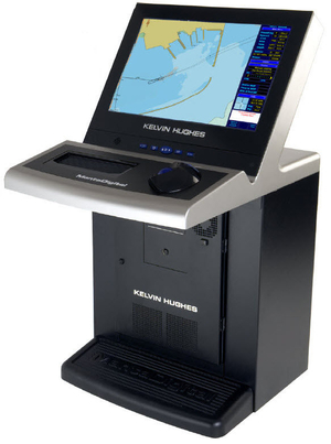
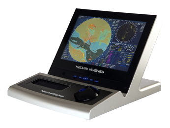
MANTADIGITAL ECDIS 22' DISPLAY
-
MANTADIGITAL ECDIS 26' DISPLAY
-
MARIS ECDIS900 МК5
-
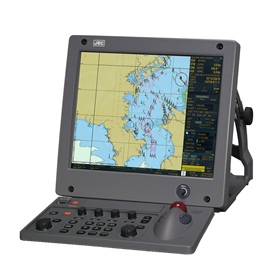
JRC NDC-2000
-
Transas ECDIS 270 24VDC, Panel PC
-

Navi-Sailor 270 ECDIS
-
Navi-Sailor 4000 ECDIS BOX
-
The display system Navi-CONNING 4000
-
FEA-2107
-
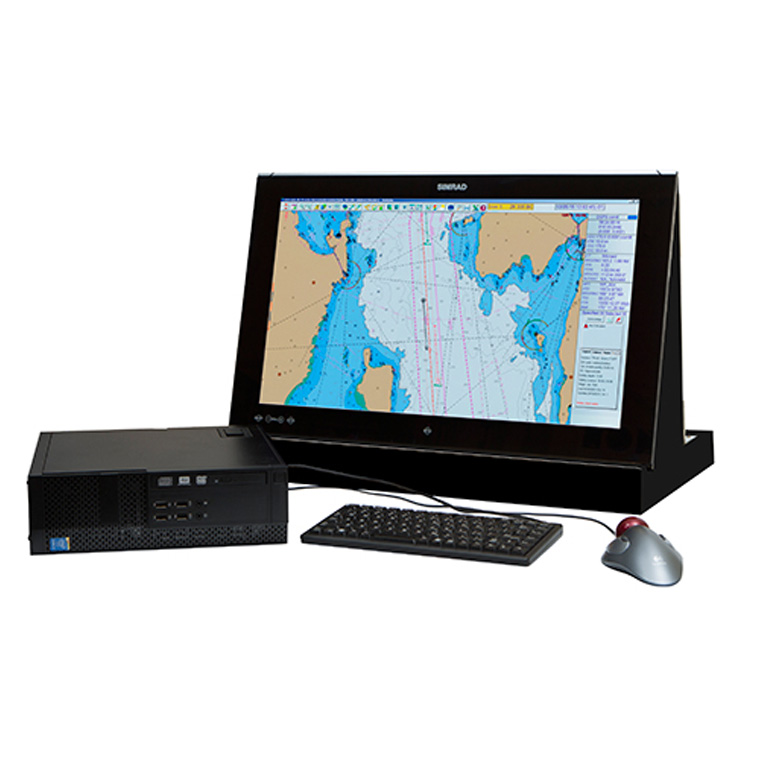
Simrad MARIS ECDIS900 MK15
-

FMD-3200/3000
-
ECDIS FMD-3100 Furuno
-

Transas iSailor
-
dKart Navigator
-
NavCom Voyager SB/MB