+7 (812) 4-673-673
FARVATER РК-2106

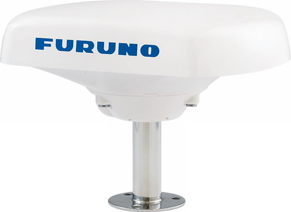
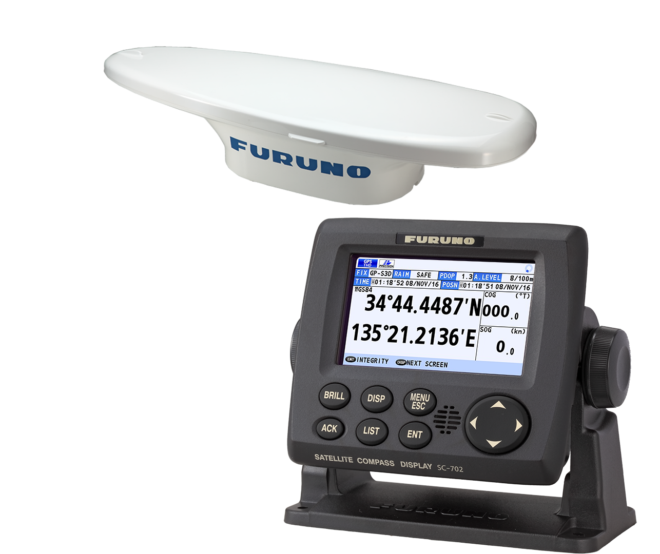
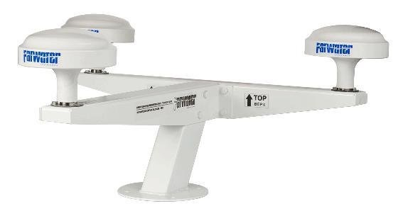
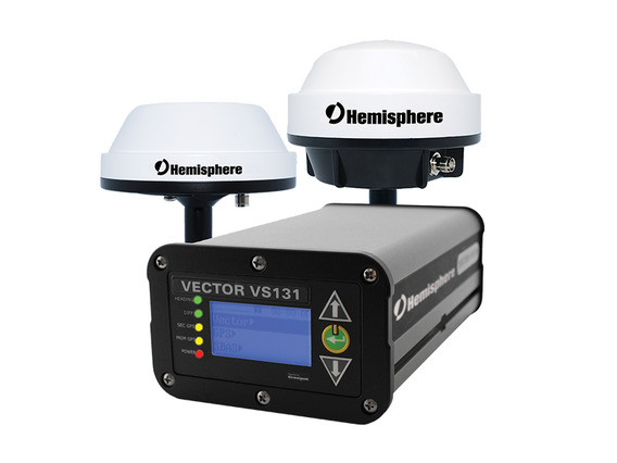
The FAIRWAY RK-2106 is a ship's combined GPS/GLONASS transceiver with the ability to determine the angles of spatial orientation of the vessel. It is widely used on river and sea vessels to accurately determine the coordinates, course and roll of the vessel, as well as to control the uniformity of filling holds or tanks.
Features of the FAIRWAY RK-2106:
Package includes:
Technical specifications:
Frequency range:
GNSS Initialization Time:
Coordinate accuracy:
Altitude detection accuracy:
The accuracy of determining the orientation angles:
The PK-2106 FAIRWAY is a reliable solution for marine and river navigation, providing high data accuracy and extensive functionality for effective ship management in various conditions.
Features of the FAIRWAY RK-2106:
- Route planning mode: Allows you to set up to 600 waypoints and monitor the movement of the vessel along a given route, displaying the bearing to the specified points, deviation from the course and entry/exit from the waypoint zone.
- MOB function (man overboard): When activated, it saves the current position of the device and switches the screen to the location where the MOB button was pressed.
- Certification of the Russian Maritime Register of Shipping (RMRS): The device has an appropriate certificate confirming its compliance with maritime norms and safety standards.
Package includes:
- Main unit with built-in GPS/GLONASS/DGPS receivers
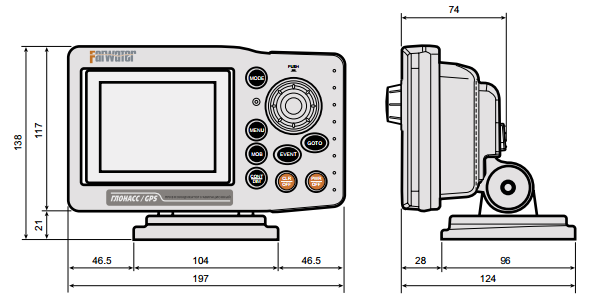
- Display and control unit
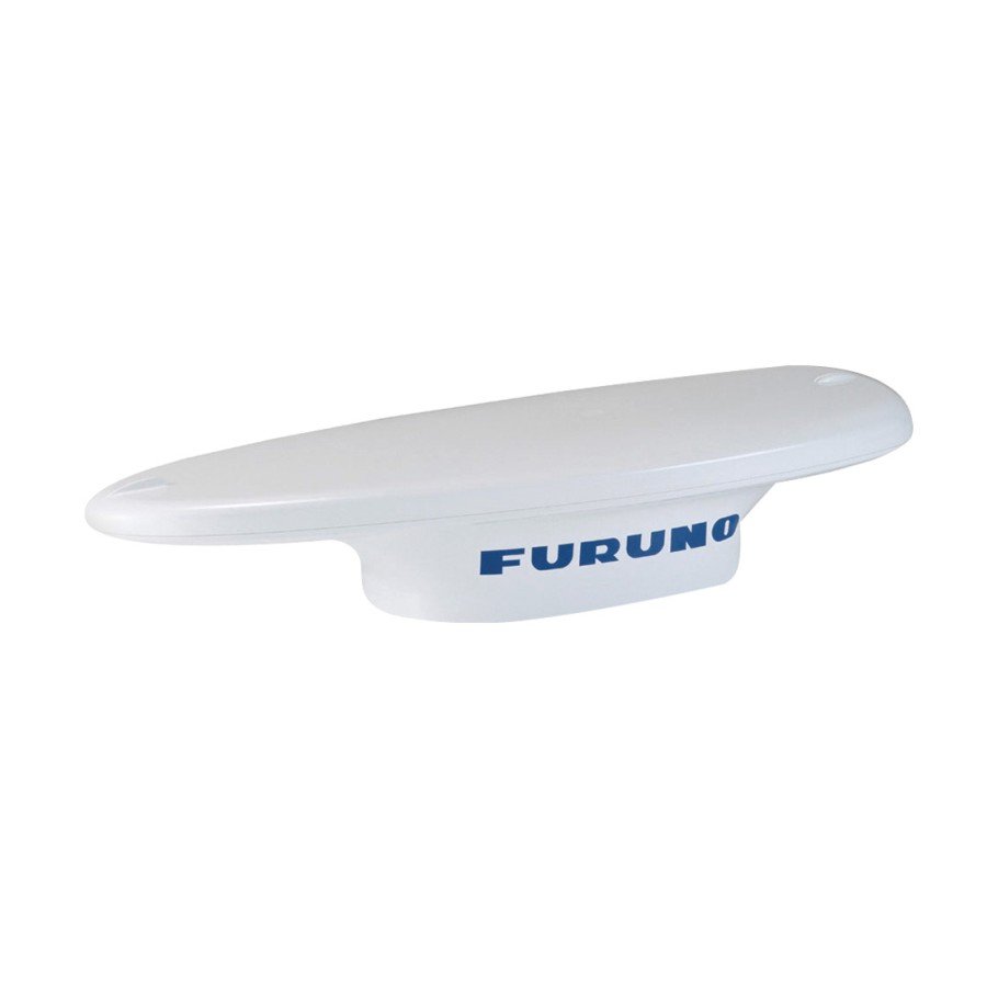
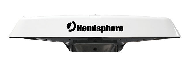
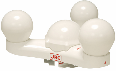
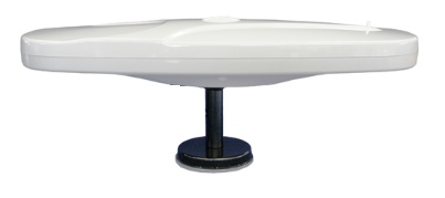
- GPS/GLONASS/DGNSS Navigation Antenna System (with 10 m cable)
- Antenna mounting pylon
- Power supply system for operation from 220 VAC or 24 VDC
- NMEA data buffer (with RS-232 and RS-422 interfaces)
- A set of mounting elements
- The operating manual in Russian
- The form
Technical specifications:
Frequency range:
- GLONASS: 1595 – 1610 MHz
- GPS: 1575.42MHz
- PKI: 283.5 – 325.0 kHz (through 500 kHz)
- Data refresh rate: 1 second
GNSS Initialization Time:
- Cold Start: 90 seconds
- Warm start: 50 seconds
- Hot start: 10 seconds
Coordinate accuracy:
- GPS/GLONASS: 9 m (typical value is 5 m)
- GNSS + SBAS: 3M
- DGPS/DGLONASS: 2 m
Altitude detection accuracy:
- GPS/GLONASS: 12 m (typical value is 8 m)
- GNSS + SBAS: 5 m
- DGPS/DGLONASS: 3 m
The accuracy of determining the orientation angles:
- Course: 0.2 per 1 m base
- Roll/trim: 0.4 per 1 m base
- Time detection accuracy: 100 nanoseconds
- Speed detection accuracy: 0.05 m/s
- Operating temperature range and humidity:
- Main unit and indicator: -15C to +55C
- Antenna: -40C to +65C, relative humidity up to 95%
- Interfaces and data exchange rates: Various standards are supported, including RTCM.
The PK-2106 FAIRWAY is a reliable solution for marine and river navigation, providing high data accuracy and extensive functionality for effective ship management in various conditions.
Other category products