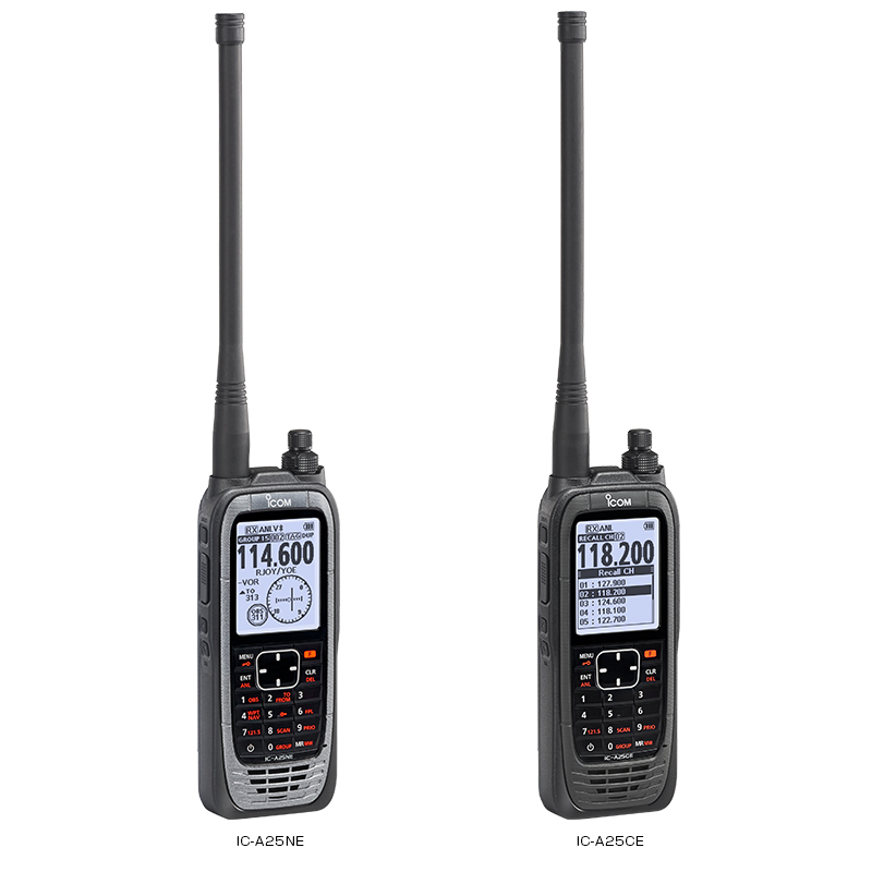
ICOM IC-A25NE / IC-A25CE
Available for order
The IC-A25NE and IC-A25CE airborne handheld radios offer enhanced reliability and many advanced features in an ergonomic design and ease of use.
Features:
Features:
- High RF output power 6W
- Easy to use interface
- Large 2.3-inch LCD
- Built-in Bluetooth® for hands-free operation (for C-A25NE)
- Intelligent battery with detailed battery status
- VOR navigation functions (for C-A25NE)
- Near station search function (for C-A25NE)
- Built-in GPS receiver with simplified navigation point NAV (for C-A25NE)
- Flight plans with Android ™ / OS ™ app (for C-A25NE)
|
IC-A25NE |
IC-A25CE | |
|---|---|---|
| NAV and COM | NAV and COM channels | COM channels |
| Frequency range |
118-136.992 MHz (TX) 108-135.992 MHz (RX) |
108-135.992 MHz (RX) |
| Number of memory channels | 300 channels/15 groups | 300 channels/15 groups |
| Channel spacing | 25/8.33 kHz | 25/8.33 kHz |
| Type of emission | 6K80A3E, 5K00A3E | 6K80A3E, 5K00A3E |
| Power supply requirement | 7.2 V DC (BP-288), 11.0 V DC (External DC Jack) | 7.2 V DC (BP-288), 11.0 V DC (External DC Jack) |
| Current drain (approximately) |
Less than 1.8 A (TX) Less than 500 mA 90 mA typ. (GPS, Bluetooth, Light: OFF) (RX) |
Less than 1.8 A (TX) Less than 500 mA 90 mA typ. (GPS, Bluetooth, Light: OFF) (RX) |
| Antenna impedance | 50 Ω |
50 Ω |
| Operating temperature range | −20 °C to +55 °C | −20 °C to +55 °C |
|
Dimensions (W × H × D;) (Projections not included) |
58.9 × 148.4 × 31.8 mm | 58.9 × 148.4 × 31.8 mm |
| Weight (approximately) | 340 g (with BP-288) | 340 g (with BP-288) |
 21.12.2021
Synchronous use of different types of electronic chart
If electronic charts other than ENCs are used in ECDIS then a message will be presented that warns the Navigator to use official, corrected charts for navigation
 +7 (812) 4-673-673

